City Seal The City of San Diego
HomeContact the City
City Seal
City Seal Business City Hall Community Departments Information Leisure Services A-Z Visiting

Community Profiles
Photo of Ocean Beach Pier
  San Diego Community Profile: Pacific Beach
 

Community Planning Quick Links

• Overview & Background
• Community Planning Groups (CPG)
•  Community Planning Groups Contact List (CPG) (PDF: 243K)
• Community Planners Committee (CPC)
• Community/Land Use Plans
•  Community Orientation Workshop (COW)
•  Electronic Community Orientation Workshop (E-COW)
• Community Profiles
• Get Involved in Your Community
• Other Community Planning Resources
• Community Planning Home


Go Button

Don't know what community you are in? View General Community Map

 Pacific Beach Community Links
•  Community Planning Group Agendas
• Current Community Plan
• Facilities Financing Plan
• Community Planning Group Info (PDF: 143K)
• Community Contact Information
• Demographic Information (PDF)
•  Parks & Other Community Services
• Maps
• Existing Conditions

 Planning Programs
• General Plan & Community Plans
City of Villages Strategy for Smart Growth
• Multiple Species Conservation Program
Protecting Our Environment
• Historical Resources
Protecting Our Rich Cultural Heritage
• Facilities Financing
Long range fiscal planning for public facilities
• Transportation Planning
Enhancing Mobility in San Diego
• Maps & Urban Analysis
Statistics & Customized Maps for Our Communities
• Document Library
Quick Access to Planning Re-Draft & Docketed Items

Photo of Ocean Beach Pier 
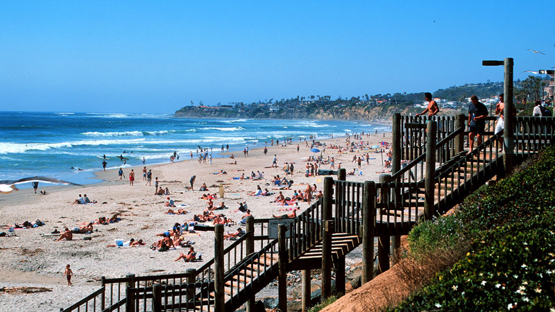
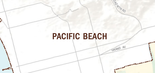
The Pacific Beach community planning area is located along the western edge of the mid-coastal region of the City of San Diego. It is bounded on the north by La Jolla, on the east by Interstate 5 and Clairemont Mesa, on the south by Mission Bay Park and Mission Beach, and on the west by the Pacific Ocean.

The primarily residential (76%) community of Pacific Beach is physically identified by its proximity to water, both the coastal bluffs and beaches of the Pacific Ocean and the beaches of Mission Bay to the south. The coastal plain that encompasses the majority of Pacific Beach rises to steep hillsides to the north, bordering La Jolla.

Pacific Beach was included within the original Pueblo Lands, which divided the area into a large grid pattern in the mid-1800s. Although residential construction began at that time, the majority of the community was built out after 1930. Approximately 97 percent of the community's land area has been developed. Consequently, the development at this time is primarily infill.

In 1970, a Mission (Beach)-Pacific Beach Community Plan was adopted. In 1974, the City Council adopted the Mission Beach Precise Plan, amending the 1970 plan to remove the Mission Beach planning area from it, thus creating the first Pacific Beach Community Plan. The advent of the Coastal Act was one of the many reasons to update the plan in 1983, creating the Pacific Beach Community Plan and Local Coastal Program Land Use Plan. That plan was amended in 1990 to reduce the residential land use designation density in most of the community's multiple dwelling unit areas. A subsequent plan update in 1995 that dealt with a range of issues resulted in the plan currently in use.


Contact City Planning & Community Investment at (619) 235-5200 or email us at planning@sandiego.gov
202 C Street, MS 5A, San Diego, CA 92101

| Planning Division Home | About Us | Programs & Projects | General Plan | Top of Page |
| Community Planning | Boards & Commissions | Get Involved | Document Library | Site Map |
Site Map Privacy Notice Disclaimers