City Seal The City of San Diego
HomeContact the City
City Seal
City Seal Business City Hall Community Departments Information Leisure Services A-Z Visiting
Planning Department
Planning Department HomeAbout UsPrograms & ProjectsGeneral PlanCommunity PlanningBoards & CommissionsGet InvolvedDocument LibrarySite Map
Community Profiles
Photo of Community Neighborhood
  San Diego Community Profile: 
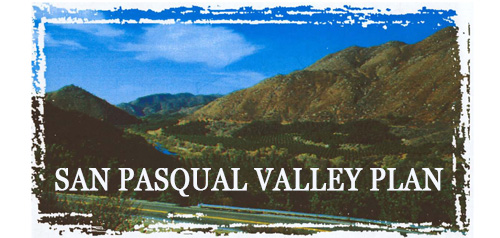
San Pasqual Valley
 

Community Planning Quick Links

• Overview & Background
• Community Planning Groups (CPG)
•  Community Planning Groups Contact List (CPG) (PDF: 243K)
• Community Planners Committee (CPC)
• Community/Land Use Plans
•  Community Orientation Workshop (COW)
• Community Profiles
• Get Involved in Your Community
• Other Community Planning Resources
• Community Planning Home


Go Button

Don't know what community you are in? View General Community Map

 San Pasqual Valley Community Links
•  Community Planning Group Agendas
• Current Community Plan
• Facilities Financing Plan
• Community Planning Group Info (PDF: 143K)
• Community Contact Information
• Demographic Information (PDF)
•  Parks & Other Community Services
• Maps
• Existing Conditions

 Planning Programs
• General Plan & Community Plans
City of Villages Strategy for Smart Growth
• Multiple Species Conservation Program
Protecting Our Environment
• Historical Resources
Protecting Our Rich Cultural Heritage
• Facilities Financing
Long range fiscal planning for public facilities
• Transportation Planning
Enhancing Mobility in San Diego
• Maps & Urban Analysis
Statistics & Customized Maps for Our Communities
• Document Library
Quick Access to Planning Re-Draft & Docketed Items

Photo of San Pasqual Valley 
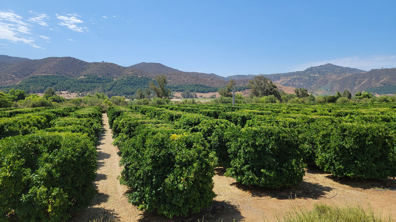
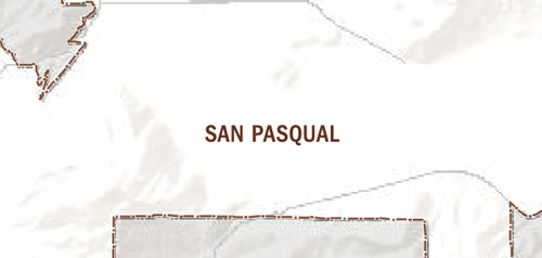
The San Pasqual Valley plan area includes approximately 14,000 acres in area and is largely owned by the City of San Diego Water Utilities Department. Agricultural land uses dominate the valley's landscape and include various orchard, vine, field crops, dairy operations, and pasture land. The valley is located in the northern most portion of the City of San Diego. The valley is bounded on the north by the city of Escondido, on the east and west by unincorporated land within San Diego County, and on the south by the city of Poway and the Rancho Bernardo community.

In the late 1950s, the Water Utilities Department acquired the San Pasqual Valley for water-supply purposes. In the early 1960s, land within the San Pasqual Valley was annexed to the City of San Diego. The first San Pasqual Valley Plan was adopted in May of 1964. That Plan designated the valley as an agricultural and open space preserve. The San Pasqual Valley Plan Area extends from the Hodges Reservoir eastward to Clevenger Canyon located at the eastern reach of the valley. The Hodges Reservoir landscape includes the broad, open waters of the Hodges Reservoir and the contrasting steep, rocky slopes of the surrounding mountainous terrain to the north and south.


Contact Planning at (619) 235-5200 or e-mail us at planning@sandiego.gov
202 C Street, MS 4A, San Diego, CA 92101

| Planning Department Home | About Us | Programs & Projects | General Plan | Top of Page |
| Community Planning | Boards & Commissions | Get Involved | Document Library | Site Map |
Site Map Privacy Notice Disclaimers