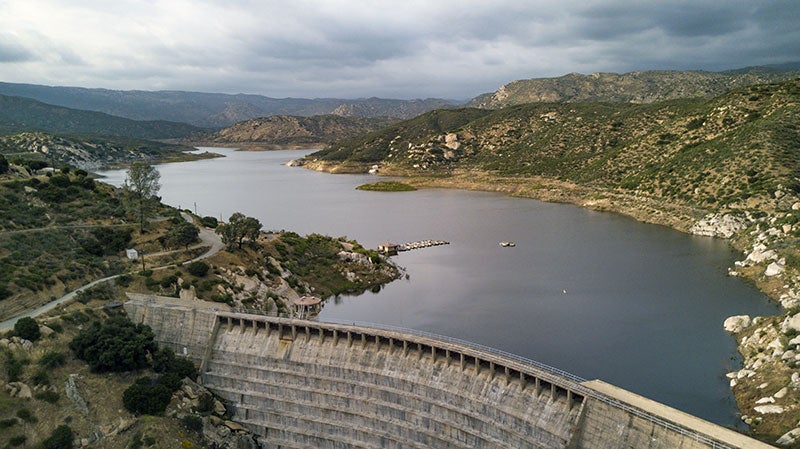
Water Levels
Last updated on May 6, 2024
Water Levels are updated weekly but may be sporadic or late due to unforeseen circumstances.
| Reservoir | Depth When Full | Current Depth | Storage Capacity (AF) | Current Storage (AF) | Storage Change (AF) | Percent Full | Spill MGD |
|---|---|---|---|---|---|---|---|
| Barrett | 160.40 ft | 159.55 ft | 34,805.5 | 33,740.3 | 65.21 | 96.9% | 0 |
| El Capitan | 197.00 ft | 136.24 ft | 112,806.9 | 41,133.6 | 6.84 | 36.5% | 0 |
| Hodges | 115.00 ft | 79.70 ft | 30,632.6 | 5,886.6 | (60.48) | 19.2% | 0 |
| Miramar | 114.00 ft | 107.50 ft | 6,682.4 | 5,787.1 | 71.90 | 86.6% | 0 |
| Morena | 157.00 ft | 122.00 ft | 50,694.0 | 13,861.4 | 168.84 | 27.3% | 0 |
| Murray | 95.00 ft | 87.16 ft | 4,684.2 | 3,478.7 | 6.85 | 74.3% | 0 |
| Lower Otay | 136.08 ft | 136.54 ft | 47,066.9 | 46,059.3 | 0 | 97.9% | 0 |
| San Vicente | 306.00 ft | 291.28 ft. | 249,358.0 | 225,284.8 | 1,745.64 | 90.3% | 0 |
| Sutherland | 145.00 ft | 95.64 ft. | 29,508.1 | 8,914.0 | (835.19) | 30.2% | 0 |
AF = acre-foot; 1 acre-foot equals about 326,000 gallons or enough water to cover an acre of land, about the size of a football field, one foot deep. MGD = Million gallons per day.
Launch Ramp Operation Levels
| Reservoir | Elevation and Gauge of Water Level at Spill | Elevation and Gauge of Lowest Water Level for Operable Ramp | ||
|---|---|---|---|---|
| Elevation | Gauge | Elevation | Gauge | |
| Barrett | 1,607.00 ft | 160.88 ft | No Ramp | No Ramp |
| El Capitan | 750.00 ft | 197.00 ft | 663.00 ft | 110.00 ft |
| Hodges | 315.00 ft | 115.00 ft | 292.00 ft | 92.00 ft |
| Miramar | 714.00 ft | 114.00 ft | 705.00 ft | 105.00 ft |
| Murray | 536.50 ft | 95.00 ft | 527.50 ft | 86.00 ft |
| Lower Otay | 484.20 ft | 137.50 ft | 465.70 ft | 119.00 ft |
| San Vicente | 766.00 ft | 306.00 ft | 640.00 ft | 180.00 ft |
| Sutherland | 2,057.00 ft | 145.00 ft | 1,982.00 ft | 70.00 ft |