City of San Diego Continues Road Repair Projects in Rancho Bernardo and Scripps Ranch
August 10, 2023
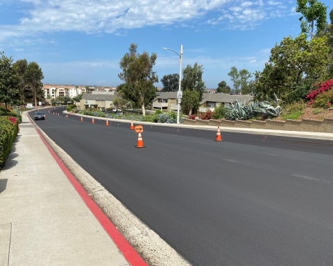
Several City of San Diego neighborhoods will soon have improved and safer streets thanks to the continuing slurry seal program that is repairing and resurfacing roads citywide. Over the next few weeks, the City will resurface streets in and around Rancho Bernardo and Scripps Ranch.
Preventing the deterioration of streets is vital to improving the overall condition of San Diego’s road network. It reduces the need for a more costly asphalt overlay and reconstruction of badly deteriorated streets.
Slurry seal is often completed in phases over several days or weeks, and multiple slurry seal projects are happening across the city simultaneously.
The latest slurry projects will be completed, weather permitting, through the month of August. The following roads will be resurfaced:
- West Bernardo Drive near Poblado Road
- Fairhope Road near Bernardo Center Drive
- Adena Lane near Fairhope Road
- Drayton Hall Way near Fairhope Road
- Fairhope Court near Fairhope Road
- Devereux Road near Tatia Court
- Tatia Court near Devereux Road
- Belle Helene Court near Devereux Road
- Marymount Place near Devereux Road
- Parlange Place near Devereux Road
- Rienzi Place near Devereux Road
- Tretagnier Circle near Devereux Road
- Bellechase Circle near Tretagnier Circle
- Versailles Court near Bellechase Circle
- Scripps Vista Way to Affinity Court
- Erma Road near Scripps Westview Way
Slurry seal is a cost-effective pavement preservation method consisting of asphalt emulsion, sand and rock. This mixture is applied to the street surface at an average thickness of a quarter inch and extends the life of streets already in good condition.
Streets are selected for resurfacing through a pavement management system that helps determine when to schedule streets. Each street segment is assigned an Overall Condition Index (OCI) based on the pavement’s roughness and cracks.
To prioritize street paving, the OCI is used in conjunction with other factors, such as traffic volume, road type, equity, climate resiliency, mobility, maintenance history, other construction projects, and available funding. Repairs are often grouped within a neighborhood to include streets in similar conditions or performed after other projects, such as pipeline replacement.
View a map of street repair and other projects in your neighborhood by visiting the City’s interactive Project Finder map.
Filter by Category
Arts and Culture (8)
Business (16)
Environment (39)
Human Interest (5)
Library (11)
Parks and Recreation (14)
Personnel (9)
Public Safety (18)
Public Works (54)
Technology (2)
Arts and Culture (8)
Business (16)
Environment (39)
Human Interest (5)
Library (11)
Parks and Recreation (14)
Personnel (9)
Public Safety (18)
Public Works (54)
Technology (2)