New Road Repair Projects Begin in Clairemont, Bay Ho, City Heights, Ridgeview and Emerald Hills
September 20, 2023
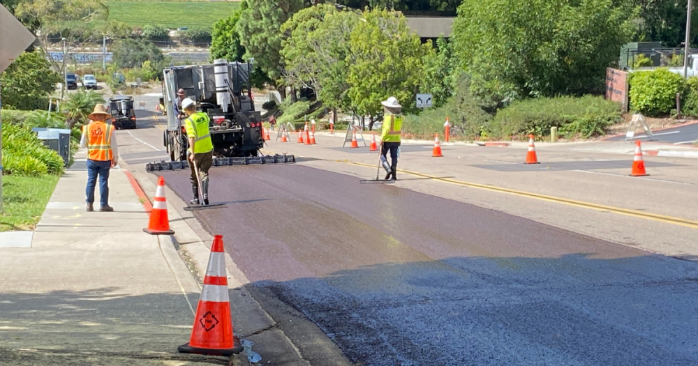
Several City of San Diego neighborhoods will soon have improved and safer streets thanks to the start of a new slurry seal project, part of an overall effort to repair and resurface roads citywide. Starting Wednesday, Sept. 20, the City will begin resurfacing streets in and around Clairemont, Bay Ho, City Heights, Ridgeview and Emerald Hills.
Preventing the deterioration of streets is vital to improving the overall condition of San Diego’s network of roads. It reduces the need for a more costly asphalt overlay and reconstruction for badly deteriorated streets.
Slurry seal is often completed in phases over several days or weeks, and multiple slurry seal projects are happening across the City simultaneously. The latest slurry projects will be completed, weather permitting, over the next three weeks. The following roads will be resurfaced:
- Fargo Avenue
- El Penon Way
- Hidalgo Avenue
- Edell Place
- Fawn Avenue
- Isleta Avenue
- Arroyo Lindo Avenue
- Barby Place
- Naugatuck Avenue
- Jutland Drive
- Arcola Avenue
- Atwell Street
- Guilitoy Avenue
- Massasoit Avenue
- Powhatan Avenue
- Della Place
- Gallatin Way
- Alexandria Drive
- Calaveras Drive
- Osprey Street
- Washington Place
- Pine Street
- Ingleside Street
- Sunset Boulevard
- Witherby Street
- Barcelona Drive
- Moana Drive
- Bayview Heights Drive
- Home Avenue
- Federal Boulevard
- Fairmount Avenue
Slurry seal is a cost-effective pavement preservation method consisting of asphalt emulsion, sand and rock. This mixture is applied to the street surface at an average thickness of a quarter inch and extends the life of already in-good-condition streets.
Streets are selected for resurfacing through a pavement management system that helps determine when to schedule streets. Each street segment is assigned an Overall Condition Index (OCI) score based on the pavement’s roughness and cracks.
To prioritize street paving, the OCI is used in conjunction with other factors, such as traffic volume, road type, equity, climate resiliency, mobility, maintenance history, other construction projects, and available funding. Repairs are often grouped within a neighborhood to include streets in similar conditions or performed after other projects, such as pipeline replacement.
View a map of street repair and other projects in your neighborhood by visiting the City’s interactive Project Finder map.
Filter by Category
Airports (1)
Arts and Culture (9)
Business (20)
City Planning (1)
Environment (46)
Human Interest (7)
Library (14)
Parks and Recreation (21)
Personnel (11)
Public Safety (20)
Public Works (58)
Streets (1)
Technology (4)
Transportation (1)
Airports (1)
Arts and Culture (9)
Business (20)
City Planning (1)
Environment (46)
Human Interest (7)
Library (14)
Parks and Recreation (21)
Personnel (11)
Public Safety (20)
Public Works (58)
Streets (1)
Technology (4)
Transportation (1)