— Project —
Community Heat Mapping
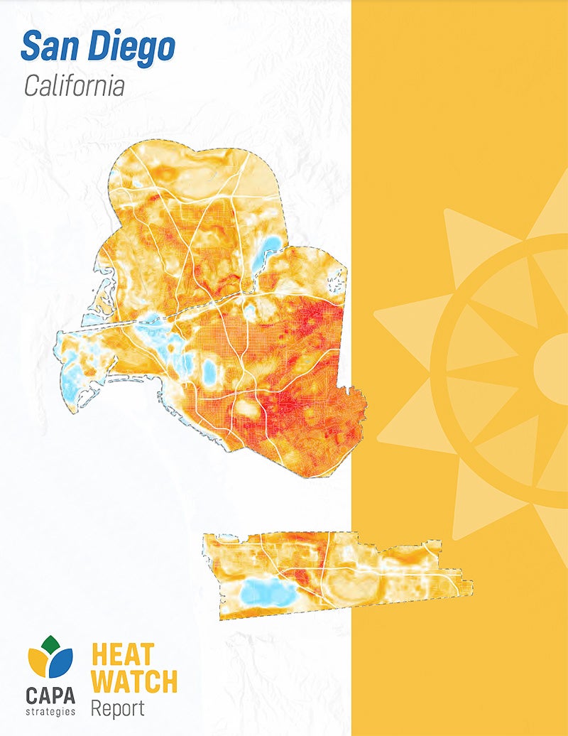
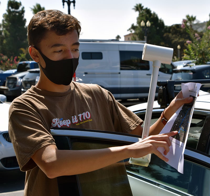
On Sept. 13 and 14, 2021, the City partnered with the San Diego Foundation, High Tech High and other volunteers to hold an urban heat mapping event. Using heat sensors, volunteers traveled along designated routes and collected thousands of temperature and humidity data points in the morning, afternoon and evening. The data was then sent to CAPA Strategies who created high resolutions maps to show heat distribution across the City.
The urban heat mapping results are just one tool the City will use to strategically decide where to prioritize the implementation of strategies that address extreme heat. This project was funded by a grant from National Oceanic and Atmospheric Administration (NOAA) and CAPA Strategies. Learn more about the event and view the report.