Zoning
The City Council adopted the Official Zoning Map on Feb. 28, 2006. See Report to City Council 06-020 for background information on the development of the Official Zoning Map.


Zoning Use and Development Regulations
All properties within the City of San Diego have zoning designations reflecting the current designations in the Land Development Code.
Need to look up your Zoning Use Designation to obtain a City San Diego Business Tax Certificate?
You will be required to self-certify that your proposal is allowed in the zone that applies to the property where the business activity will be conducted. You may use the following online resources to perform self-certification:
Step 1
Verify the base zone designation of your business’s location by visiting ZAPP.
Step 2
Verify that the land use and development regulations are permitted by searching the use and development regulations tables within each section below.
- SDMC Chapter 13 - Zones
- Open Space Base Zones (OP, OC, OF, OS)
- Agricultural Base Zones (AG, AR)
- Residential Base Zones (RE, RS, RX, RT, RM)
- Commercial Base Zones (CN, CR, CO, CV, CP, CC)
- Industrial Base Zones (IP, IL, IH, IS, IBT)
- Mixed-Use Base Zones (RMX, EMX)
- Planned District Ordinance Zones (Zones not listed above)
Base Zones Types
Most property in San Diego falls into one of the following types of base zones:
- Residential: Areas designated for single and multi-family residences.
View Regulations Per Residential Base Zone - Commercial: Areas intended for businesses that provide consumer goods and services as well as a wide variety of commercial, retail, office and recreational uses.
- Industrial: Areas intended for research and development, factories, warehousing and other industrial uses.
- Agricultural: Areas now used for agricultural and farming purposes that may be developed for urban use sometime in the future.
- Open Space: Public recreational uses or areas to be left in a generally natural state
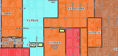
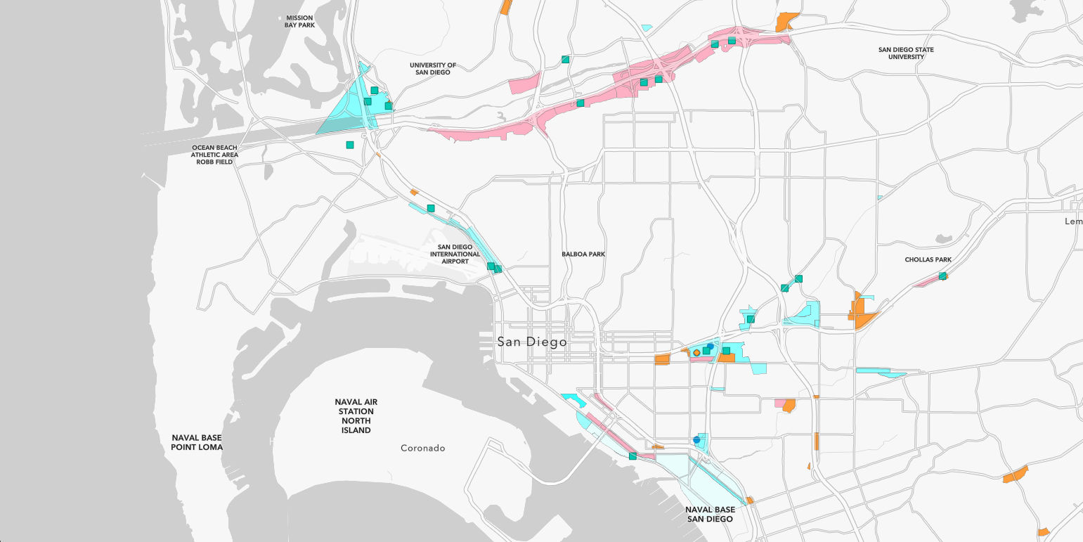
Overlay Zones and Other Site Criteria
Overlay zones and other site criteria are used to determine if additional regulations, approvals or permits are required. For example, a site in a Specific Plan or Community Plan Implementation Overlay zone may have different or additional requirements than the base zone. A project located within the Coastal Overlay Zone may require approval of a Coastal Development Permit prior to issuance of any construction permit. A site within any environmentally sensitive land layers would require additional information to be submitted with any permit application in order for staff to confirm the presence of environmentally sensitive lands that could require a Site Development Permit or Neighborhood Development Permit.
- Parking Impact Overlay Zone: This overlay zone provides supplemental parking regulations for specified coastal beach and campus areas that have parking impacts per San Diego Municipal Code §132.0801.
- Annual Holiday Construction Restriction: Each year, during the peak holiday shopping season, between Thanksgiving Day and New Year's Day, construction-related activities on streets adjacent to major retail shopping areas.