1927 Aerial View of Coronado, North Island, Spanish Bight
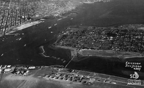
Photo by Harry (Jimmy) Erickson, 12/9/1927
Aerial view of San Diego Bay, Coronado and North Island taken in December 1927 while Coronado was still separated from North Island by a shallow channel called the Spanish Bight. The development of North Island by the United States Navy prior to and during World War II led to the filling of the bight by July 1944, combining the land areas into a single body. (Photo by Erickson)