1930 Aerial View of La Jolla from Big Rock Reef to the Cove
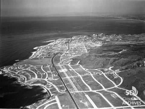
Photo by Harry (Jimmy) Erickson, 12/7/1930
Aerial view of La Jolla taken in 1930. Located 12 miles north of downtown San Diego, La Jolla occupies 7 miles of curving coastline along the Pacific Ocean. It began as pueblo lands during the Mexican period of San Diego's history. During the 1880's real estate boom it was subdivided by Frank T. Botsford and George W. Heald. By 1900 there were 350 residents, and now there are over 40,000. It is home to a variety of businesses and scientific research, including UCSD, the Salk Institute, and Scripps Institution of Oceanography.