Savage Dam (Previous Lower Otay Dam) and Lower Otay Reservoir
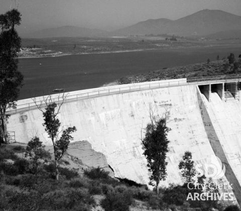
Photo by City Photographer, 1968
1968 aerial photo of Savage Dam (previously called Otay Dam) and Lower Otay Reservoir. The Lower Otay Reservoir was connected to the City of San Diego's water system in 1906 via the Bonita Pipeline. Following heavy rains (ostensibly the work of the 'rainmaker' Charles Hatfield) the dam burst in 1916 and the Otay Valley was flooded. The dam was rebuilt in 1918 and renamed Savage Dam. When full, Lower Otay Reservoir has 1,100 surface acres, a maximum water depth of 137.5 feet, and 25 shoreline miles.