Better by Bike - Bike Lane Latest
![]()
Bike Lane Latest

Join the conversation in your community
Getting involved in the community planning process helps the City understand how to prioritize projects based on community infrastructure requests.
Provide input to your community planning group about bike upgrades and connections! Encourage neighbors, family and friends to get involved too.
1
Step 1: Learn more about local community planning groups.
3
Step 3: Review the agenda and attend meetings.
Help the City learn how you get around by bike
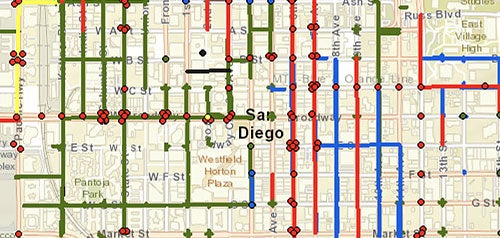
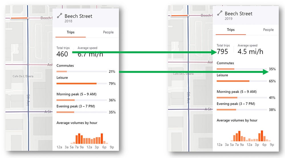
The City of San Diego utilizes Strava Metro to monitor ridership and compare year to year trends for changes in utilization of bike lanes for commuting or recreational riding.
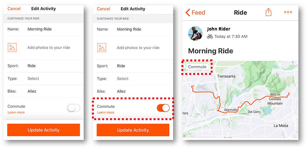
Download the Strava app to track your commutes.
Slide the commute button on the activity recording to mark your commute rides:
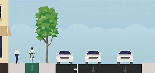
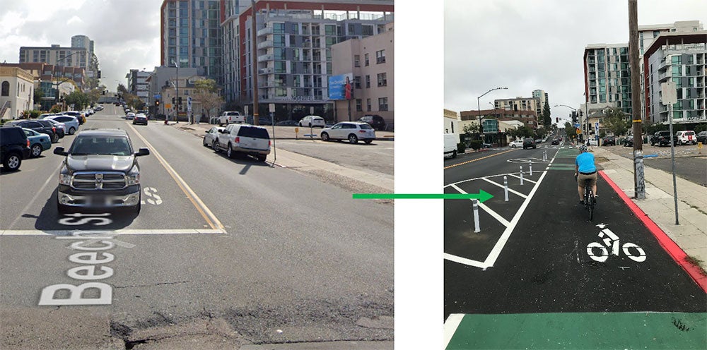
Strava data shows that from 2018 to 2019 Beech Street in Downtown saw an increase in the number of total trips as well as the number of people using this lane to commute to work. This increase corresponds with the installation of a new protected bike lane.
Strava also syncs with the Love to Ride app, which lets you track your rides, set goals, earn badges, invite friends and even earn prizes!
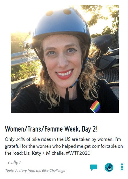
In May 2020, more than 500 San Diegans participated in the Love to Ride Bike Month Challenge. Sign up for 'Cycle September' 2020 to ride with and encourage people worldwide and you'll have the chance to win prizes like a new bike!