Very High Fire Hazard Severity Zones
New! 2025 Fire Hazard Severity Zone Map Released
The Office of the State Fire Marshal (OSFM) has released the updated 2025 Local Responsibility Area (LRA) Fire Hazard Severity Zone (FHSZ) Map. For detailed information and to view the new map, visit the 2025 LRA FHSZ Map Page.
State law requires that all local jurisdictions identify very high fire hazard severity zones within their areas of responsibility. Inclusion within these zones is based on vegetation density, slope severity and other relevant factors that contribute to fire severity.
- Frequently Asked Questions
- State code section mandating identification of very high fire hazard severity zones
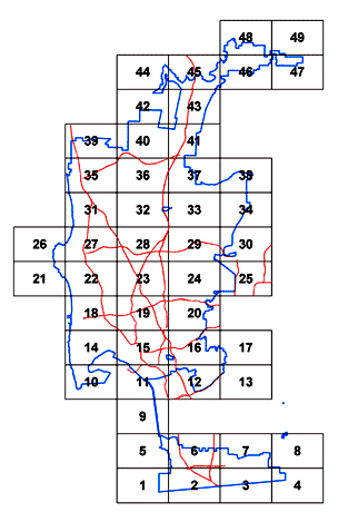
Very High Fire Hazard Severity Zone Map
The purpose of this map is to classify lands in accordance with whether a very high fire hazard is present so that public officials are able to identify measures that will retard the rate of fire spread and reduce the intensity of uncontrolled fire through vegetation management and implementation of building standards developed to minimize loss of life, resources and property.
For a larger view of a grid in PDF format, select a tile from the map below or a link on the right.
- Grid 1 (PDF)
- Grid 2 (PDF)
- Grid 3 (PDF)
- Grid 4 (PDF)
- Grid 5 (PDF)
- Grid 6 (PDF)
- Grid 7 (PDF)
- Grid 8 (PDF)
- Grid 9 (PDF)
- Grid 10 (PDF)
- Grid 11 (PDF)
- Grid 12 (PDF)
- Grid 13 (PDF)
- Grid 14 (PDF)
- Grid 15 (PDF)
- Grid 16 (PDF)
- Grid 17 (PDF)
- Grid 18 (PDF)
- Grid 19 (PDF)
- Grid 20 (PDF)
- Grid 21 (PDF)
- Grid 22 (PDF)
- Grid 23 (PDF)
- Grid 24 (PDF)
- Grid 25 (PDF)
- Grid 26 (PDF)
- Grid 27 (PDF)
- Grid 28 (PDF)
- Grid 29 (PDF)
- Grid 30 (PDF)
- Grid 31 (PDF)
- Grid 32 (PDF)
- Grid 33 (PDF)
- Grid 34 (PDF)
- Grid 35 (PDF)
- Grid 36 (PDF)
- Grid 37 (PDF)
- Grid 38 (PDF)
- Grid 39 (PDF)
- Grid 40 (PDF)
- Grid 41 (PDF)
- Grid 42 (PDF)
- Grid 43 (PDF)
- Grid 44 (PDF)
- Grid 45 (PDF)
- Grid 46 (PDF)
- Grid 47 (PDF)
- Grid 48 (PDF)
- Grid 49 (PDF)
- City Map (PDF: 25Mb)