Pacific Beach - Previous Planning Efforts, Studies and Reports
Mission Boulevard Public Spaces & Active Transportation Plan
Final Report
Mission Boulevard Public Spaces and Active Transportation Final Report
Project Background
The Mission Boulevard Public Spaces and Active Transportation planning effort is a SANDAG grant funded effort led by the City of San Diego (grant application) .The plan seeks to identify opportunities for public spaces, bicycle and pedestrian improvements in the area bounded by Mission Boulevard, Pacific Beach Drive, Diamond Street, and the boardwalk (Project Study Area).
Project Initiation and Discovery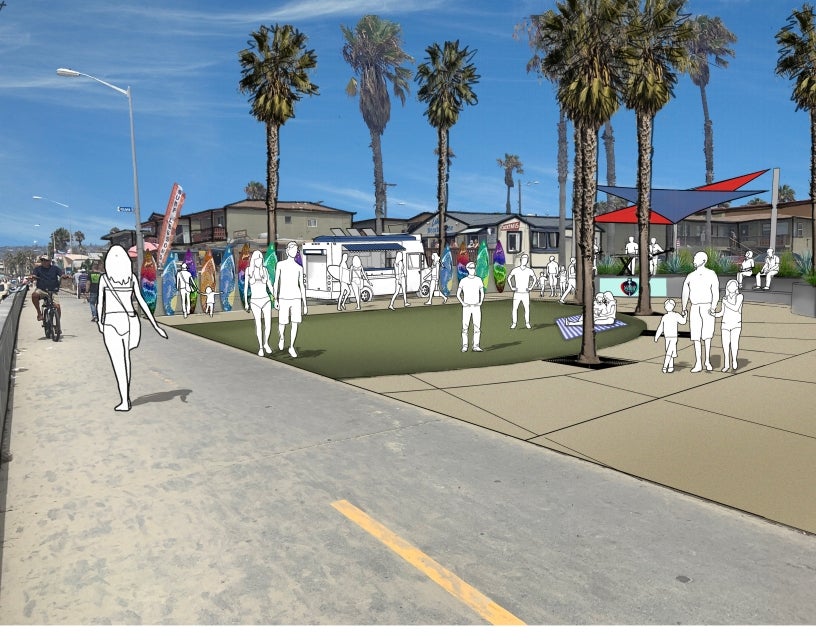
The project team conducted stakeholder interviews in November 2016, performed a field walk of the project area, and reviewed previous studies. In addition, an aerial topographic survey of the area was performed. After these activities, the project consultants have identified areas of opportunities and constraints within the project corridor. These areas are identified in graphical format in the following documents:
Mobility Analysis and Concepts
An existing conditions report and opportunities and constraints assessment to evaluate and analyze pedestrian, bicycle, transit and vehicular conditions in the study area has been prepared and willb e incorporated into the study. Urban Design and Mobility concepts have been developed, identifying multi-modal streetscape and urban design improvements to enhance pedestrian, bicycle, and transit facilities.
Community Workshop #1
On September 13, the City of San Diego Planning Department held a Community Workshop at the Pacific Beach/Taylor Library. The document below contains the exhibits that were shown at the Community Workshop and it also contains the questions that attendees were asked. The online (PDF) and a printed version of the contents of Workshop #1 was available through November 9, 2018 for the public to provide feedback by answering the questions included.
Mission Boulevard Public Spaces and Active Transportation - Workshop #1 Exhibits and Comments Forms


Images from Community Workshop #1 - September 13, 2018
Community Workshop #2
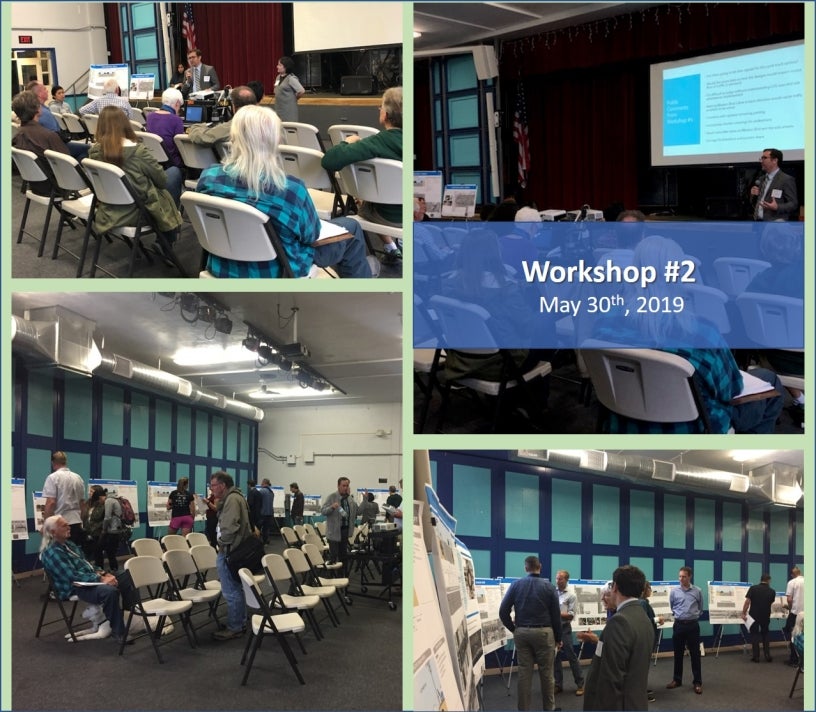 Community Workshop #2 for the Mission Boulevard Public Spaces & Active Transportation plan, took place on Thursday, May 30th, 2019 at the Auditorium of Crown Point Elementary School.
At Community Workshop #2 we presented the refined concepts for Mission Boulevard (between Pacific Beach Drive and Diamond Street), and for the following streets (between Mission Boulevard and Ocean Boulevard): Diamond Street, Emerald Street, Felspar Street, Garnet Avenue, Hornblend Street, Grand Avenue, Thomas Avenue, Reed Avenue, Pacific Beach Drive,
The document below contains the exhibits that were shown at the Community Workshop and it also contains the questions that attendees were asked. The online (PDF) and a printed version of the contents of Workshop #1 was available through June 21st, 2019 for the public to provide feedback by answering the questions included.
Community Workshop #2 (Online Version)
Open House
The City of San Diego Planning Department hosted an open house on Wednesday, August 28th. The concepts prepared as part of the Mission Boulevard Public Spaces and Active Transportation study were presented to the community. The study includes the proposal and evaluation of pedestrian, bicycle and public space improvements for the area bounded by Mission Boulevard, Pacific Beach Drive, Diamond Street, and Ocean Boulevard.
Contact Us
For questions or comments regarding the Mission Boulevard Public Spaces & Active Transportation planning effort, please contact: Melissa Garcia, Senior Planner, at MAGarcia@SanDiego.gov.
Community Planning
Planning Department
9485 Aero Drive, M.S. 413
San Diego, CA 92123
619-235-5200
planning@sandiego.gov