100 Years of City Planning
Celebrating 100 Years of San Diego Planning (1926–2026)
In 2026, the City Planning Department officially turns 100 years old! For a century, we have been dedicated to comprehensive, strategic planning to create safe, enjoyable, and healthy communities for all San Diegans. Take a journey through the decades to see how our city has transformed from a visionary master plan into America’s Finest City.
The San Diego Planning Timeline
1920s: The Vision Begins
- 1926 – A Master Plan is Born: The City invited visionary planner John Nolen to draft San Diego's first official master plan (adopted in 1929). His plan sparked a movement for wide streets, a connected park system, and a dedicated Civic Center.
- The First Directors: Inspired by Nolen, the City established the City Planning Department in 1926. Kevin Gardner, who worked for Nolen, served as the first Planning Director, followed by Glenn Rick in 1928.
1930s – 1950s: Shaping Icons & Infrastructure
- The First City Hall: In 1938, Rick spearheaded City Hall’s move from the Gaslamp Quarter to the waterfront with the construction of the City’s first Administration Center along Pacific Coast Highway. The Administration Center housed both City and County of San Diego offices for decades and still serves the region today as the County Administration Center.
- Mission Bay Park: By the late 1940’s, the City planned and began dredging to create Mission Bay Park. Spanning 4,235 acres of public open space, it became the largest man-made aquatic park in the country.
1960s: Big City Vision & Community Engagement
- Downtown Modernization: Investment pours into Downtown San Diego, in which leads to the opening of the Civic Center in 1965—including a new city hall, civic theater, and convention space along C Street.
- The 1967 General Plan: After working closely with residents to address property rights and redevelopment concerns, the City Council adopts its first comprehensive General Plan known as the “Progress Guide and General Plan”. This helps to cement community engagement as a core part of the City’s planning process.
1970s: Balancing Growth & Ecology
- "Temporary Paradise?": A landmark 1974 report, called “Temporary Paradise?”, by consultants Kevin Lynch and Donald Appleyard challenged the City to strike a balance between growth, infrastructure, and environmental preservation.
- Community Planning: In 1976, the City Council established Council Policy 600-24 to encourage the formation and recognition of local community planning groups to formalize a way for community voices to advise the City.
- Managing Growth: The 1979 General Plan introduced a three-tiered growth strategy and established Development Impact Fees, ensuring developers help fund the public facilities, infrastructure, and services needed for growing neighborhoods.
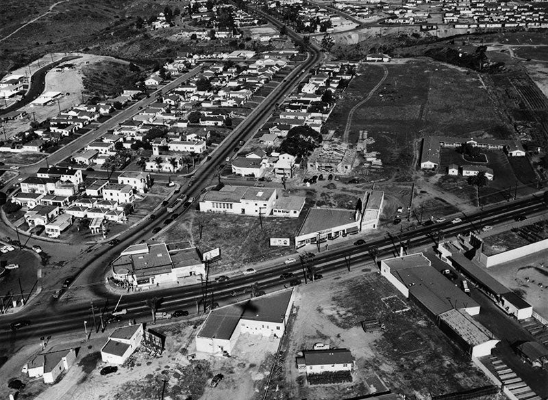
Then: The first long-range plan for the College Area was adopted in 1965 to address the evolving needs of the community.
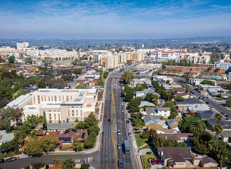
Now: Since then, the College Area Community Plan has been updated five times, including its most recent update in 2025.
1980s – 1990s: Revitalizing the Skyline
- Downtown Renaissance: A mix of public and private investments in the 1980s transformed Downtown San Diego. The historic Gaslamp Quarter was revitalized, Horton Plaza opened, and the iconic San Diego Trolley began rolling from downtown to the United States-Mexico border.
- Protecting Our Neighborhoods: In 1992, new Guidelines for Future Development were added to the General Plan to protect environmentally sensitive areas and single-family neighborhoods while monitoring urban performance goals.
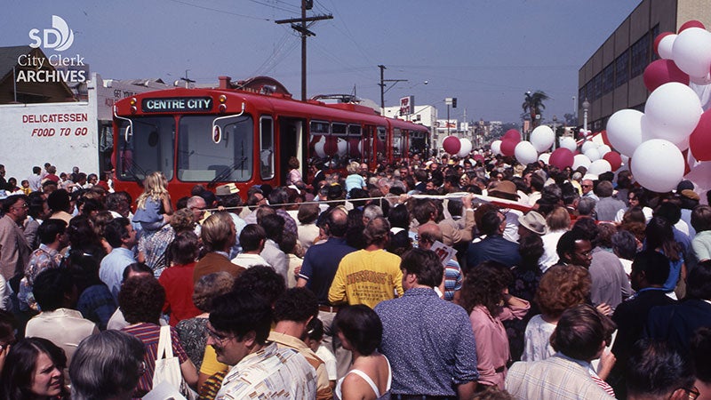
Then: San Diego's first-ever light rail vehicle began service in 1981.
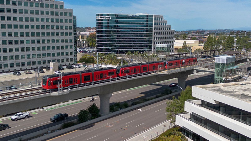
Now: The City supported early transit planning efforts and continues to align growth with transit, including the 2024 update to the General Plan, known as Blueprint SD.
2000s: A "City of Villages"
- The 2008 General Plan: After 30 years, a comprehensive update set a new gold standard centered on sustainability. The update introduced the City of Villages strategy, focusing growth into pedestrian-friendly, mixed-use neighborhoods connected by regional transit. This framework lays the groundwork for San Diego's first Climate Action Plan.
2020s & Beyond: Equity, Resilience, and Blueprint San Diego
Recent global shifts have highlighted the vital need for equitable planning. Today, we are actively correcting historical planning disparities to build a resilient future for all San Diegans.
- 2021 Parks Master Plan: Expands equitable access to clean, meaningful recreational spaces.
- 2022 Climate Action Plan: Targets greenhouse gas reductions and prioritizes investments in the communities that need them most.
- 2024 Environmental Justice Element: Embedded directly into the General Plan to limit environmental burdens and promote healthy, livable spaces in underserved areas.
- 2024 Blueprint San Diego: A proactive update to the General Plan that maps out where future homes and jobs can be supported by affordable walking, biking, and transit options.
Looking Ahead: Our 5 Strategic Priority Areas of Focus
One hundred years after the Nolen Plan, growth remains a defining chapter of our history. As we look to the next century, the City Planning Department is moving forward with five clear priorities for an equitable and sustainable San Diego:
- Creating Homes for All of Us – Expanding housing options for all incomes and family sizes.
- Protecting & Enriching Every Neighborhood – Enhancing public spaces and neighborhood character.
- Advancing Mobility & Infrastructure – Building safer, connected ways to walk, roll, bike, and ride transit.
- Championing Sustainability – Fighting climate change and improving local air and environmental quality.
- Fostering Regional Prosperity – Attracting jobs and driving sustainable economic growth.
To learn more about the history of planning at the City of San Diego, visit Inside San Diego's article on Celebrating 100 years of City Planning.
Thank you, San Diego, for 100 years of partnership in planning!
Let’s plan the next century together.
Planning Department
9485 Aero Drive, M.S. 413
San Diego, CA 92123
619-235-5200
planning@sandiego.gov