Biodiverse SD
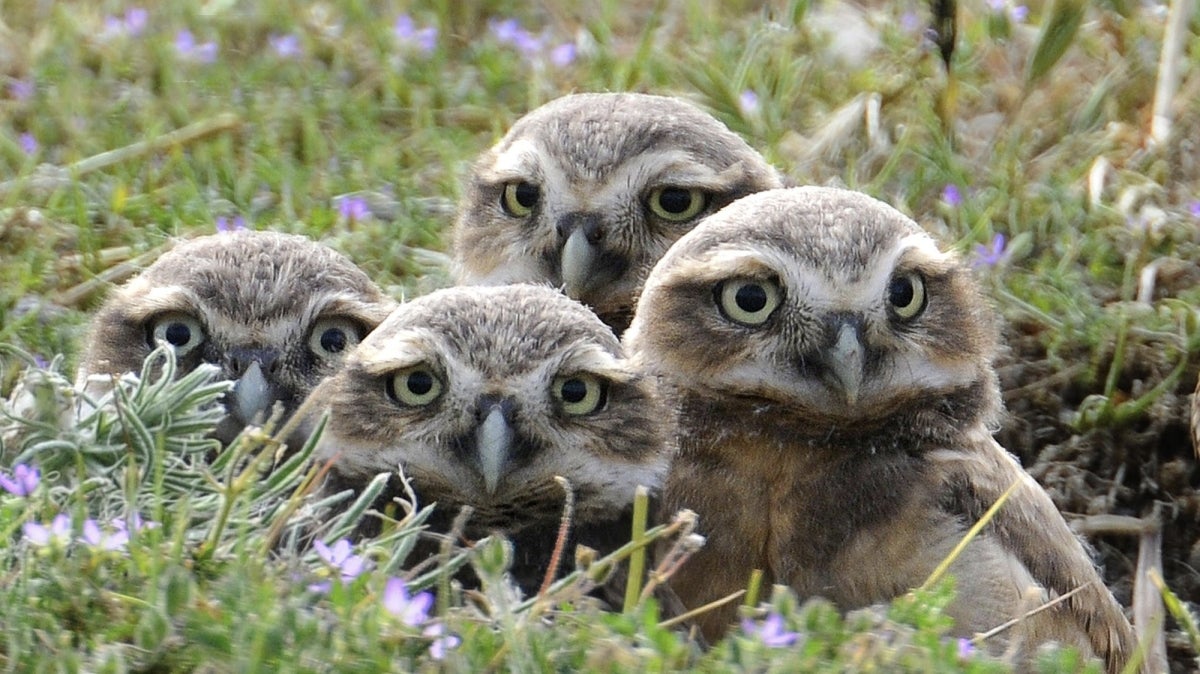
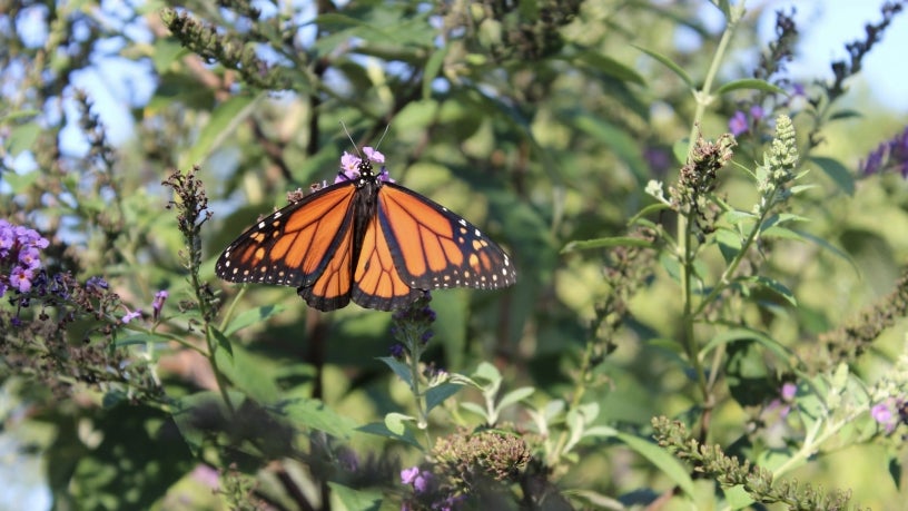
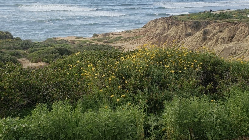
Biodiverse SD was developed to preserve a network of habitat and open space, protecting species and ecosystems that improve our quality of life. Biodiverse SD, which includes the City’s Multiple Species Conservation Program, protects 85 species, including endangered species like the California gnatcatcher and other species of concern unique to San Diego such as the western burrowing owl.
This program was developed by the City in cooperation with wildlife agencies, property owners, developers, and environmental groups. Biodiverse SD delineates core biological resource areas and corridors targeted for conservation, called the Multi-Habitat Planning Area (MHPA). Within the MHPA, limited development may occur to ensure the long-term habitat conservation plan for the 85 Covered Species addresses needs of multiple species and the preservation of natural vegetation communities.
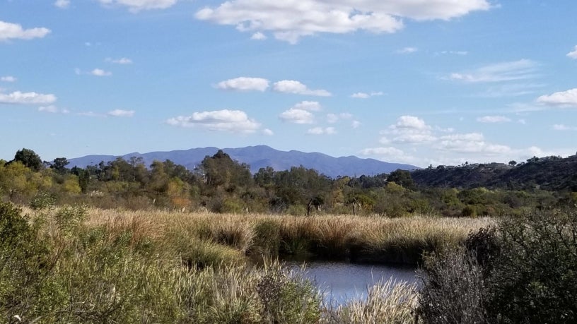
The goal of protecting these areas is to conserve this land in perpetuity and protect the region’s biodiversity. The City’s City Planning Department maintains and updates the Biodiverse SD Interactive Map (updates in progress), which allows you to see if your home is within or close to the MHPA by entering your address. While the City's map is being updated, please visit San Diego Association of Governments (SANDAG) SAN GIS map to view the interactive map. To view the MHPA, select "Ecology" in the layers tab on the right side, and then select "MHPA" in the ecology dropdown.
Strategic Plan Priority Areas of Focus
This program focuses on the following priority areas of the Strategic Plan:
Protect & Enrich Every Neighborhood
Conserves habitat and open space land in perpetuity and protects the region’s biodiversity.
Champion Sustainability
Supports the City’s greenhouse gas emissions reduction and climate resiliency goals through preservation and enhancement of habitat and natural vegetation communities.
Contacts and References
- Development Services Department General Department Information (619) 446-5000
- Email us at Biodiverse SD
- City of San Diego Park and Recreation Department- Open Space Division
- City of San Diego Public Utilities Department
- County of San Diego Multiple Species Conservation Program
- California Department of Fish and Wildlife- Natural Community Conservation Planning (NCCP)
- U.S. Fish and Wildlife Service- Habitat Conservation Planning (HCP)
- San Diego Management and Monitoring Portal
Multiple Species Conservation Program
The Multiple Species Conservation Program (MSCP) was developed to preserve a network of habitat and open space, protecting biodiversity, and enhancing the region's quality of life. The City of San Diego is one of several jurisdictions participating in the MSCP. The MSCP covers 85 species and the core biological resource areas are identified within the City's Multi-Habitat Planning Areas.
The City has completed the planning effort to identify core biological resource areas targeted for conservation and has entered into an Implementing Agreement with federal and state wildlife agencies to ensure implementation of the resource conservation plan and habitat preserve. Current efforts of City MSCP staff largely focus on project review, preserve assembly and biological monitoring.
MSCP Plan and Associated Documents
City of San Diego MSCP Subarea Plan
The City of San Diego Subarea Plan guides the establishment of the City of San Diego Multi-Habitat Planning Area (MHPA) preserve system.
- MSCP Subarea Plan - Full Version
- Table of Contents
- Introduction
- Description of Subarea
- Covered Species List
- Land Use Considerations
- Framework Management Plan
- Protection of Resources
- MSCP Implementation Funding
- Appendix A of this plan is also available as Table 3-5 in the Final MSCP Plan in the previous section.
Biological Monitoring
The City performs a variety of biological monitoring activities in conformance with the Biological Monitoring Plan for the Multiple Species Conservation Program (1996).
MSCP Annual Reporting and Workshop
The workshop provides an opportunity for the public and interested parties to learn more about unique habitats in the San Diego region and the role of the MSCP in preserving open space. Annual workshops are hosted on a rotating basis by participating jurisdictions and members of the public and other interested parties are invited to attend.
Vernal Pool Habitat Conservation Plan
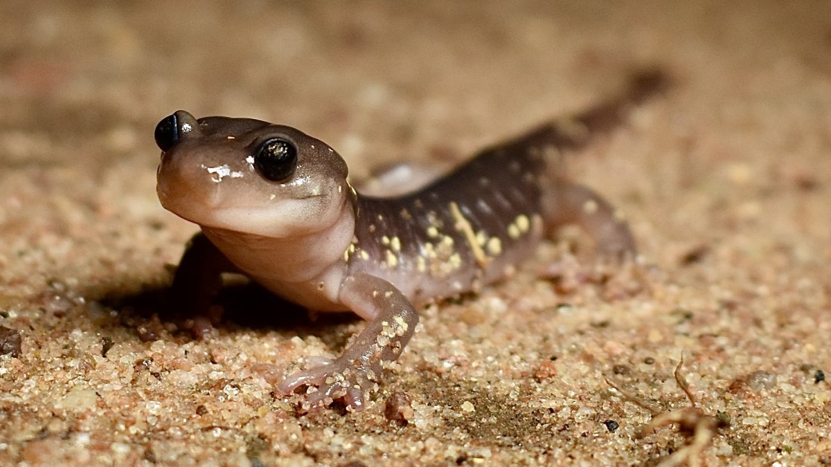
The City of San Diego Vernal Pool Habitat Conservation Plan (HCP) is intended to provide an effective framework to protect, enhance, and restore vernal pool resources within the City of San Diego, while improving and streamlining the environmental permitting process for impacts to threatened and endangered species associated with vernal pools. Access the Vernal Pool Interactive Map to locate the pools and refer to the Vernal Pool Species Data Glossary for descriptions of the vernal pool species abbreviations and attribute values used in the map data. The Vernal Pool HCP would provide coverage for threatened and endangered vernal pool species that do not currently have federal coverage under the City of San Diego's Multiple Species Conservation Program (MSCP) Subarea Plan. The Vernal Pool HCP is compatible with the MSCP and expands upon the City's existing Multi-Habitat Planning Area to conserve additional lands with vernal pool resources. The Vernal Pool HCP covered species includes the following seven threatened and endangered species:
- Otay Mesa mint (Pogogyne nudiuscula, PONU)
- San Diego Mesa mint (Pogogyne abramsii, POAB)
- Spreading navarretia (Navarretia fossalis, NAFO)
- San Diego button-celery (Eryngium aristulatum var. parishii, ERAR)
- California Orcutt grass (Orcuttia californica, ORCA)
- Riverside fairy shrimp (Streptocephalus woottoni, RFS)
- San Diego fairy shrimp (Branchinecta sandiegonensis, SDFS)
Vernal Pool Habitat Conservation Plan Documents
The City has coordinated closely with the Wildlife Agencies and consultants on the preparation of the Vernal Pool HCP as well as taking into consideration input provided by the public. See links below for the Final Vernal Pool HCP, Final EIR/EIS, Vernal Pool Management and Monitoring Plan (MMP) and associated amendments
- Vernal Pool Habitat Conservation Plan
- Vernal Pool Management and Monitoring Plan
- Vernal Pool HCP General Plan Amendment
- Vernal Pool HCP Kearny Mesa Community Plan Amendment
- Vernal Pool HCP Otay Mesa Community Plan Amendment
- Land Development Code Biology Guidelines Amendment
- Land Development Code Environmentally Sensitive Lands Amendment
- VPHCP Final EIR/EIS
VPHCP Annual Monitoring and Management Reports
- 2024 VPHCP Annual Monitoring and Management Report
- 2023 VPHCP Annual Monitoring and Management Report
- 2022 VPHCP Annual Monitoring and Management Report
- 2021 VPHCP Annual Monitoring and Management Report
- 2020 VPHCP Annual Monitoring and Management Report
- 2019 VPHCP Annual Monitoring and Management Report
Development Regulations for MSCP/VPHCP
This section is intended to provide helpful links to the most commonly referenced Multiple Species Conservation Program (MSCP) and Vernal Pool Habitat Conservation Plan implementing regulations and development guidelines and is not intended to substitute for a comprehensive review of other City regulations and land use policies that affect the MSCP.
Environmentally Sensitive Lands Regulations
The City's Municipal Code contains Environmentally Sensitive Lands (ESL) Regulations that require the overall protection of sensitive biological resources and ensure implementation of the MSCP.
Biology Guidelines
Development or activities that propose encroachment into sensitive biological resources are specifically regulated by Section 143.0141 of ESL above and by the Biology Guidelines in the Land Development Manual.
Details on sensitive biological resources (Municipal Code) Sensitive biological resources are further defined in Municipal Code Section 113.0103 and include lands that are within the Multi-Habitat Planning Area (MHPA) and lands that may support: wetlands, sensitive biology outside the MHPA, narrow endemic plants, MSCP covered species habitat and/or species regulated by state and federal endangered species acts.
Landscape Regulations
The Landscape Regulations ensure that areas adjacent to the MHPA are landscaped with native, non-invasive plants. As most areas within the MHPA are also within fir e hazard zones the brush management regulations in this section regulate fire safety compliance.
Guidelines for Conducting Biology Surveys (July 2002)
The Guidelines for Conducting Biology Surveys are intended to define the content of biology survey reports for use in the preparation of CEQA environmental documents.
Contacts and References
Contacts
- Development Services Department General Department Information (619) 446-5000
- Email us at Biodiverse SD
References
- City of San Diego Park and Recreation Department - Open Space Division
- City of San Diego Public Utilities Department
- County of San Diego Multiple Species Conservation Program
- California Department of Fish and Wildlife- Natural Community Conservation Planning (NCCP)
- U.S. Fish and Wildlife Service- Habitat Conservation Planning (HCP)
- San Diego Management and Monitoring Portal
Initiatives & Ongoing Work
- View the MHPA boundary
- View MSCP Covered Species
- View Land Development Code
- View land use adjacency guidelines
Planning Department
9485 Aero Drive, M.S. 413
San Diego, CA 92123
619-235-5200
planning@sandiego.gov